Hydrographic Office Faroe Islands
On this page, you will find information about:
Paper charts
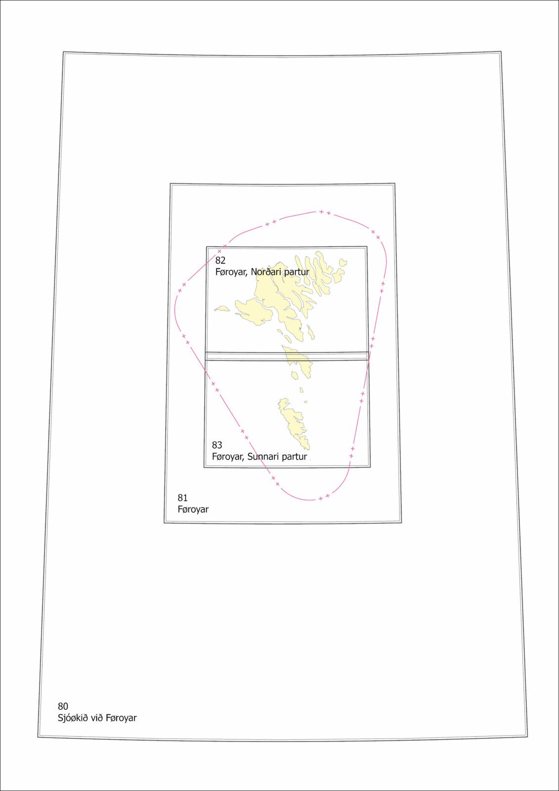
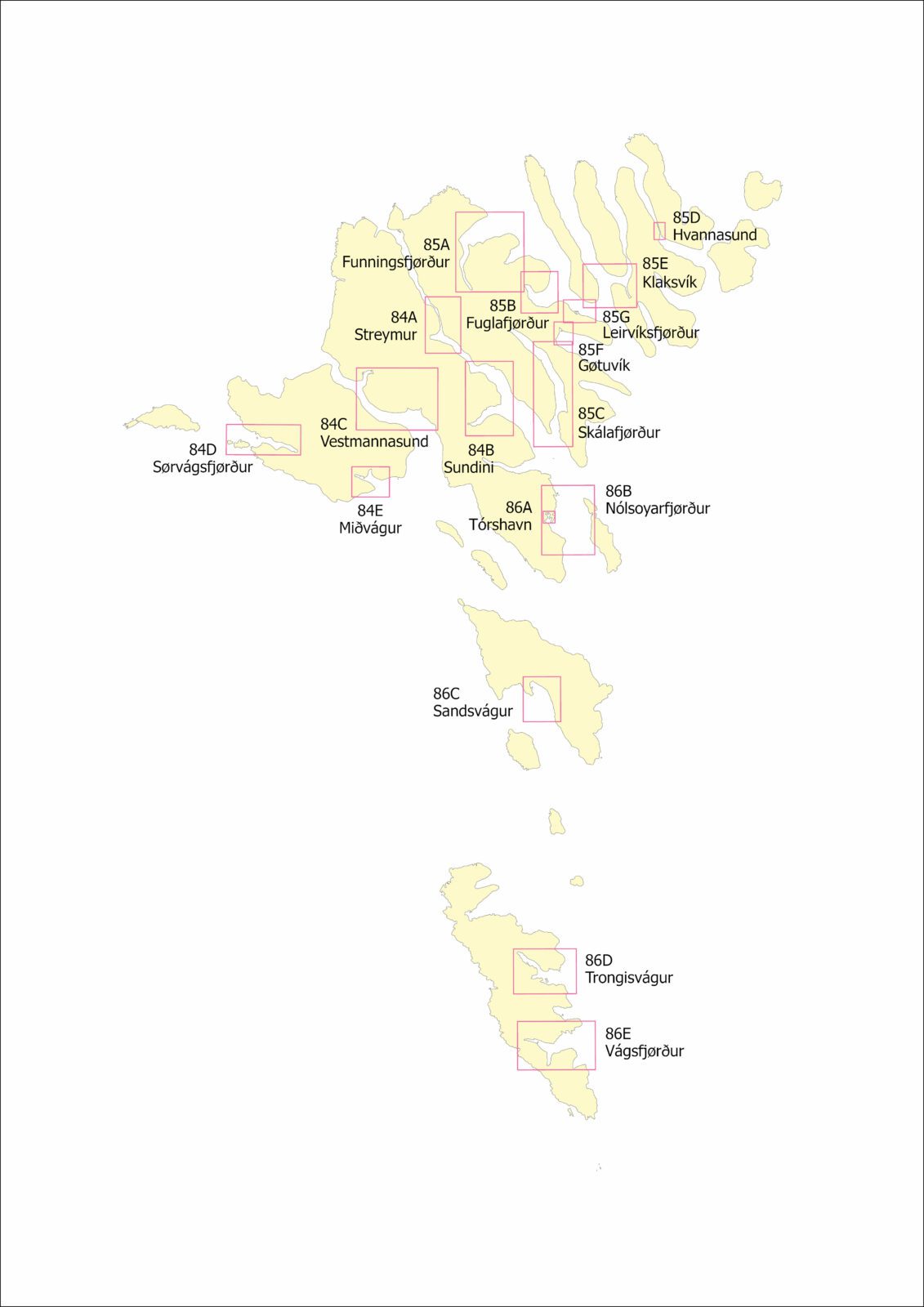
There are in total 8 paper charts available for the Faroes Islands, this also includes one INT Chart.
For paper chart corrections click here.
Paper charts can be purchased on the internet, see ‘Paper charts distributors’ here
In the Faroe Islands charts can be purchased from: H. N. Jacobsens bókahandil
Electronic charts (ENC)
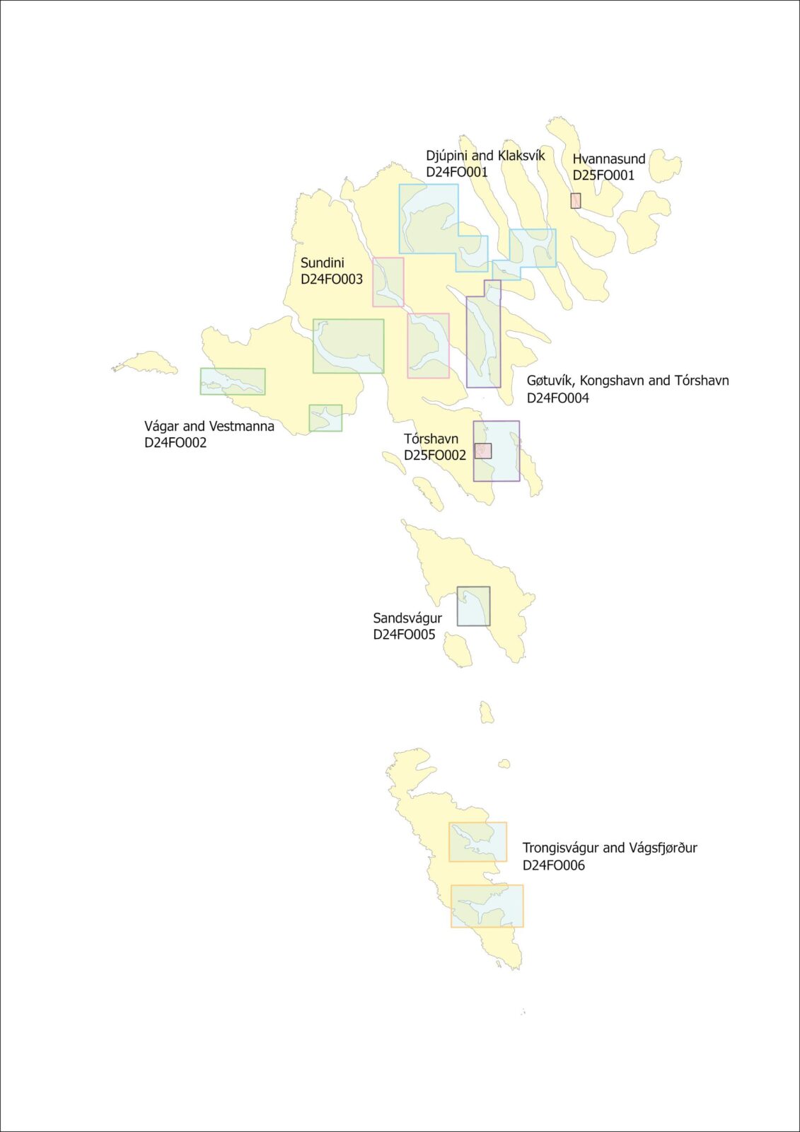
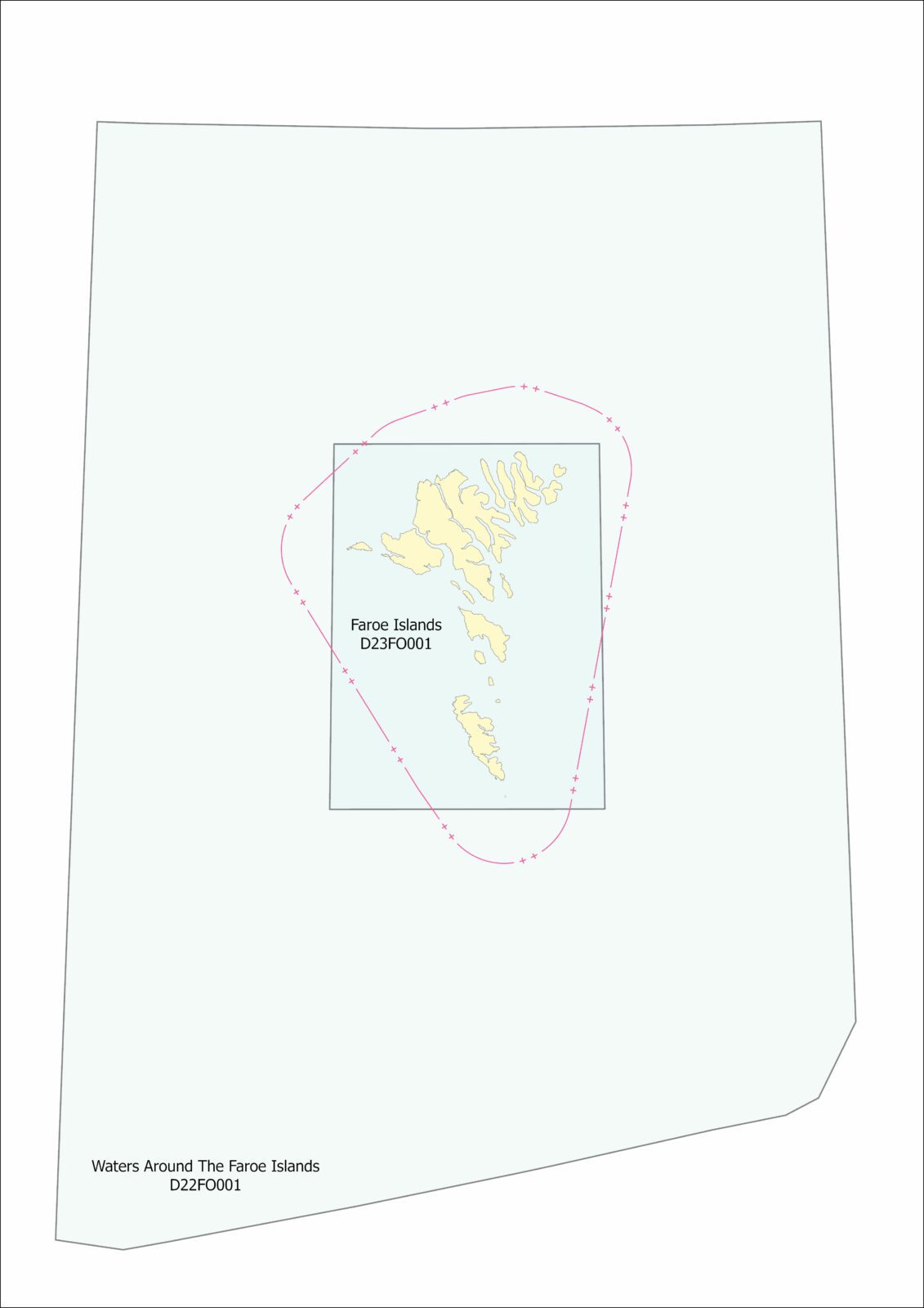
There are 10 electronic charts (ENC Electronic Navigational Chart) for the waters around the Faroe Islands.
Electronic charts can be purchased via resellers and distributors.
For more information see ic-inc.com.
Depth data and bathymetric data
The Hydrographic Office has produced a 50 meter grid of depth points around the Faroe Islands which are free and avaiable on the site Føroyakort. The area is 124 km x 90 km and is shown below.
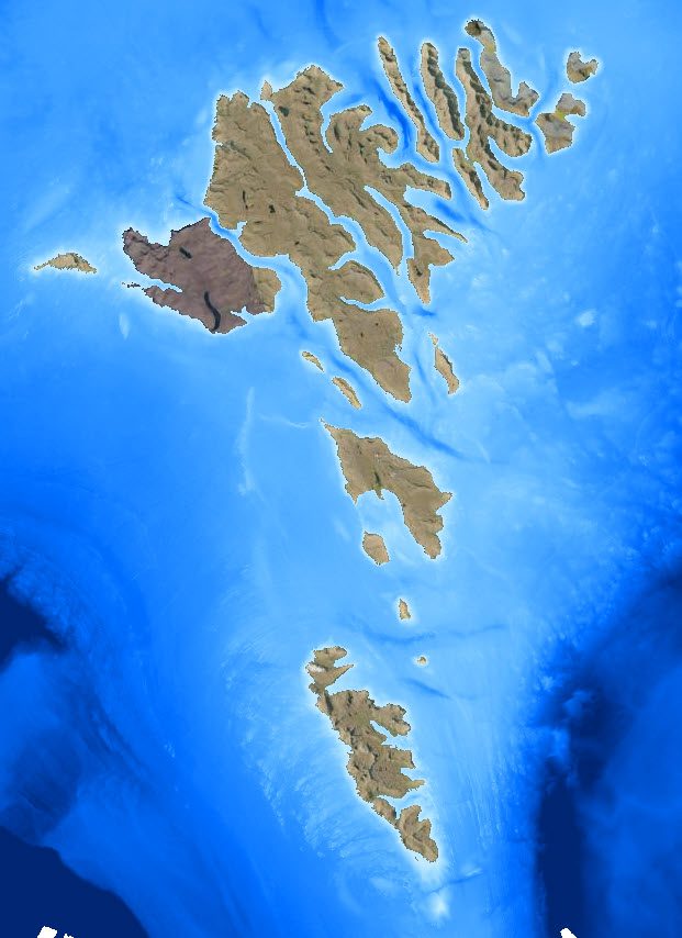
Free depth data are also available on European Marine Observation and Data Network through the following link: https://portal.emodnet-bathymetry.eu/. Please note that these depth data are in low resolution and are not updated regularly.
The Faroese Hydrographic Office possesses surveys of the Faroese waters. The surveys are of varying accuracy, given that the surveys are conducted at different times and with different technology.
The Faroese Hydrographic Office is also in the possession of surveys that are owned by other operators, for which reason the Faroese Hydrographic Office must obtain preceding permission from these other operators before data can be transferred. Please note that the Danish Defence must give a security-clearance of all transfers of depth data before the transfer can be made. We will apply for approval on your behalf. This approval is not necessary for harbour areas.
If you wish to purchase depth data or have inquiries regarding data quality, please contact sjokort@us.fo.
Hydrographic Survey – Bathymetry
Permission from Umhvørvisstovan (Faroese Environment Agency) is required to conduct bathymetric surveys in Faroese waters. Permission to survey must also be submitted for systematic surveying of wrecks.
Permission is not required from Umhvørvisstovan for bathymetric surveying within harbours as this responsibility remains with the individual harbour authority.
Permission from Umhvørvisstovan does not include authorisation for geotechnical bottom investigations. For permission to conduct a geotechnical bottom investigation please contact Jarðfeingi (Faroese Geolocial Survey).
Foreign vessels should apply for permission in the same way as Faroese vessels. This concerns maritime surveying performed by both commercial ships and private authorities.
For foreign state ships seeking permission to work in Faroese water, the application can be sent by the necessary diplomatic channels of the flag state to which the vessel is registered.
Conditions for hydrographicsurveying
A number of conditions must be met before, during and after survey work.
- Only the vessel(s) listed on the licence are permitted to survey. Updates concerning the vessel(s) used for surveying must be reported to the Danish Defence Operation Centre (opscent@sok.dk) with Cc. to Umhvørvisstovan (sjokort@us.fo).
- A copy of the survey licence must be kept on board all survey vessels at all times so that it can be presented if requested.
- Where necessary, navigational information must be provided to MRCC for navigational warning (mrcc@vorn.fo) and the Danish Maritime Authority for the promulgation and update of Notices to Mariners (efs@dma.dk).
- If objects or depths are identified as dangerous to navigation and are less than the depth stated on the navigational chart, then Umhvørvisstovan (sjokort@us.fo) and MRCC (mrcc@vorn.fo) must be notified immediately.
- If suspicious unidentified objects, remnants of ammunition or unexploded ordnance are identified during the survey, work must immediately be put on hold and the Danish Defence Operation Centre (opscent@sok.dk) contacted immediately.
- Umhvørvisstovan has the authority to inspect and control the survey at any time.
- The survey results must not be disclosed to anyone other than the client who ordered the survey task. If survey data is included in tender documents, or the alike, it must be endorsed that data cannot be disclosed to unauthorised persons. Survey results can only be used for the task specified in the application.
- Survey data must be submitted to Umhvørvisstovan in accordance with legislation §7 stk. 2 “Lov om stedbestemt information”.
Survey data must be delivered electronically as measured minimum depths and in a standard xyz format, together with a complete metadata list (describing the equipment used, calibration methods, etc.). For further information see template for metadata here.
The data must be submitted to Umhvørvisstovan within 3 months of survey completion.
Deadline
Permission for hydrographic surveying must be issued before the commencement of surveying. The processing time for bathymetry surveying permits is approximately 30 working days.
Please note that in the event of changes in the application for surveying (e.g. vessel, start/end date or location of the survey), a new case processing process will be initiated.
Umhvørvisstovan and the consultation parties are endeavouring to process the application as quickly as possible.
Template for application for maritime survey Umsóknarskjal must be sent to Umhvørvisstovan (sjokort@us.fo).
Nautical Chart Corrections
This page contains links to the latest and previously issued chart corrections.
Chart corrections published this year: Sjókortrættingar 2025
Sjókortrættingar 2024
Sjókortrættingar 2023
Sjókortrættingar 2022
Sjókortrættingar 2021
Chart corrections for each individual chart since it was printed:
80 Waters around the Faroe Islands
81 Faroe Islands
82 Faroe Islands Northern Part
83 Faroe Islands Southern Part
84 Harbours and anchorages, North-Western Part
85 Harbours and anchorages, North-Eastern Part
86 Harbours and anchorages, Southern Part
F Faroe Islands with Maritime Zones
NAVIGATIONAL INFORMATION
Notice to Mariners in the Faroe Islands are available from FMA and Navigational Warnings are available from Vørn.
ABOUT CHART CORRECTIONS
Up-to-date nautical charts and nautical publications are vital to ensure safe passage.
When acquiring a nautical chart, it is the navigator’s responsibility to update the chart with corrections that are dated after the publication date of the chart in question.
You can register to subscribe to ‘Notice to Mariners’ and receive the latest Faroese chart corrections at FMA .
Nautical Publications
List of nautical publications concerning the Faroe Islands
- Admiralty Sailing Directions NP52
- Tide Tables, Vestfallskyrrindi, DMI
- Lighthouse, Vitar og siglingarleiðir, Landsverk
- Dansk Fyrliste 2022 , Søfartsstyrelsen
- Bag om søkortet
- Kort 1 * INT 1
Contact
For any questions, please contact:
Sjókort
Sjókortmyndugleiki


